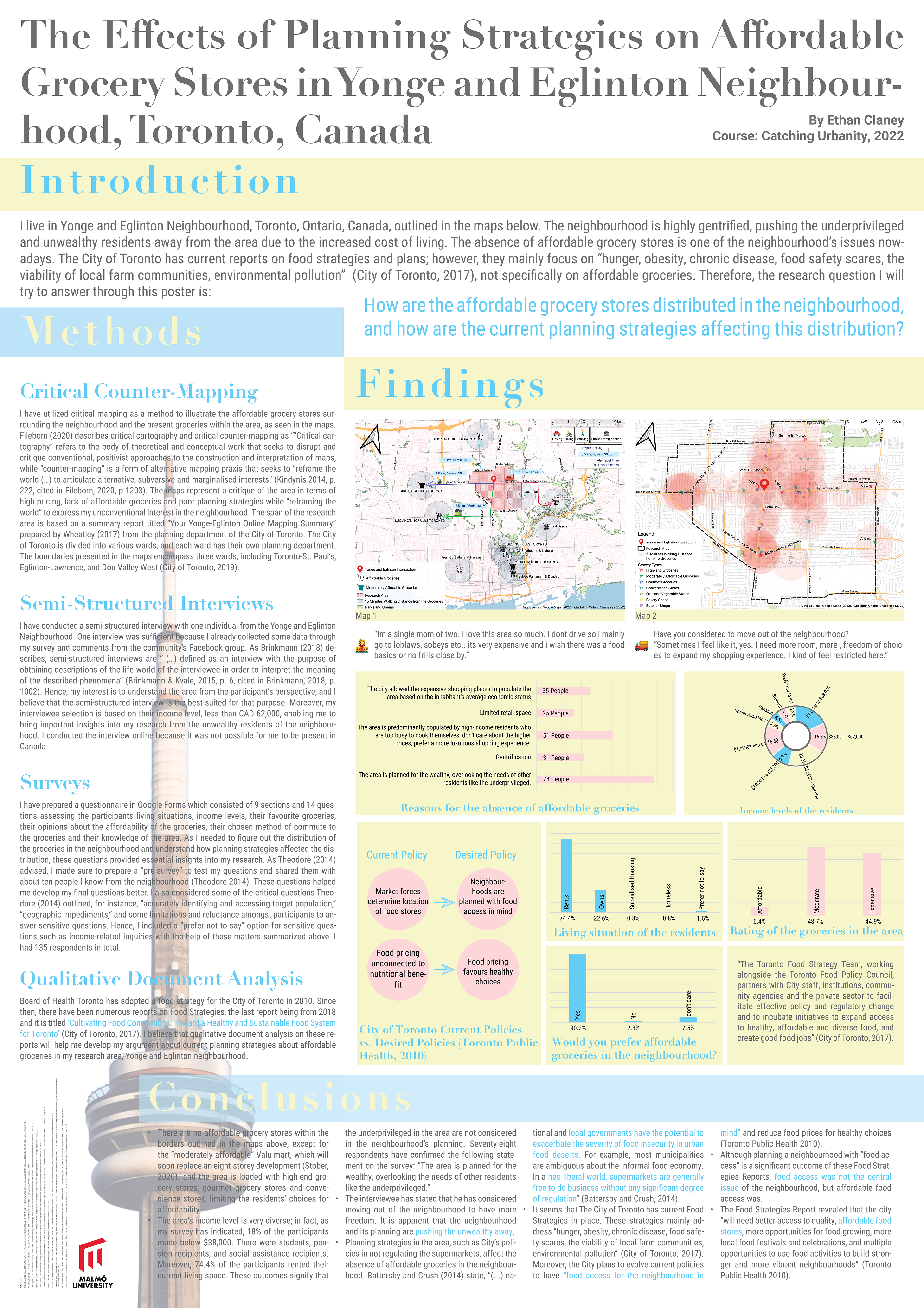
This project, conducted during the Catching Urbanity course at Malmö University from January to March 2022, focused on investigating the effects of planning strategies on affordable grocery stores in my neighbourhood, Yonge & Eglinton. I employed a critical approach and utilized counter-mapping techniques to analyze the area.
As a top contributor to our neighbourhood's Facebook Group, I leveraged this platform to conduct a survey among residents. The survey quickly gained traction (with around 150 respondents), sparking a heated debate on the comments section about the challenges people face in accessing affordable food.
The research process was an invaluable learning experience. It allowed me to develop crucial skills in QGIS and map-making and enhanced my understanding of quantitative methods and analysis.
The culmination of this project was a poster crafted using Adobe Illustrator. The poster was later printed and exhibited at the end of the semester.
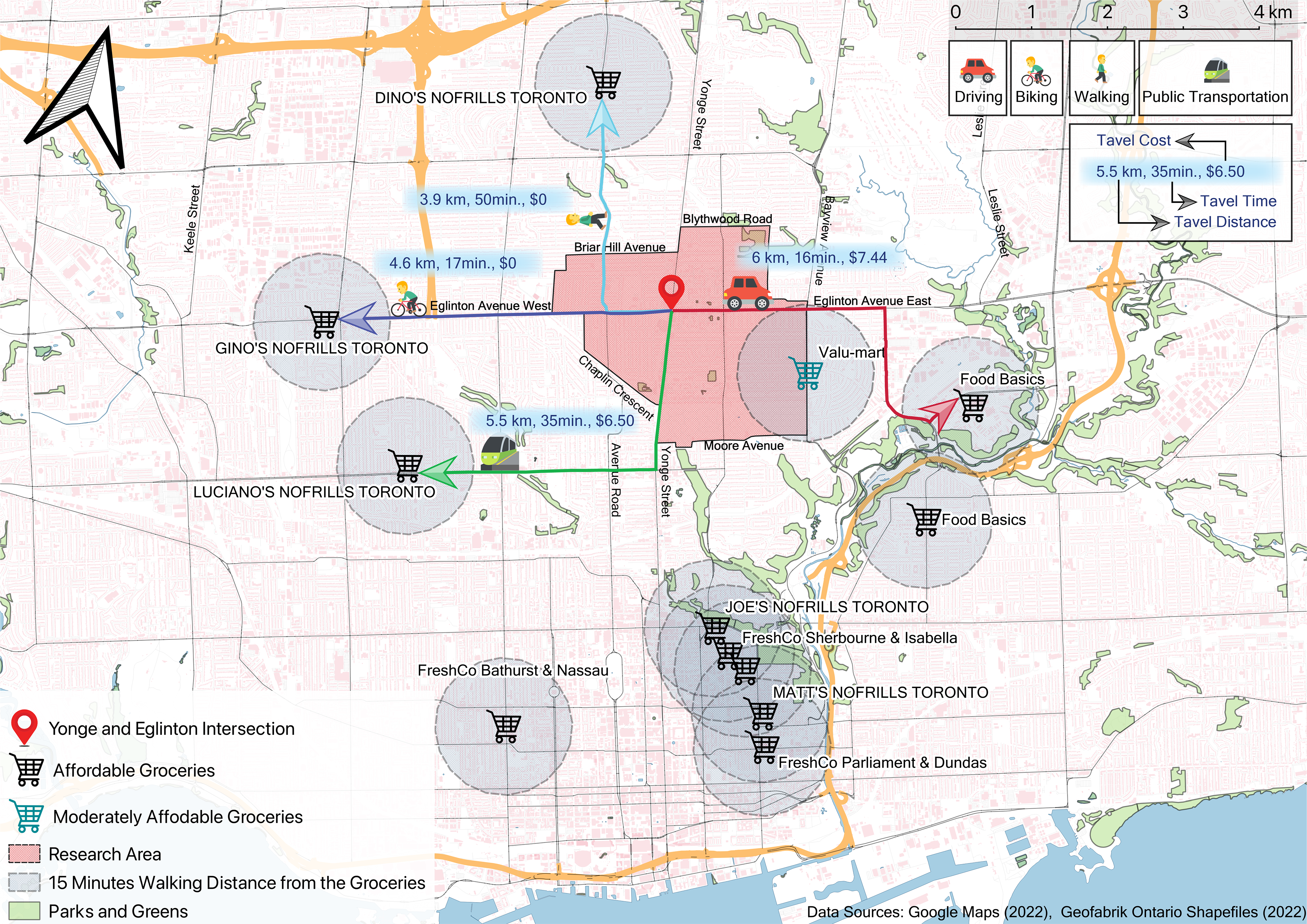
Map 1: This map illustrates the spatial relationship between affordable grocery stores and the research area, highlighting a 15-minute walk radius from each store. It visually demonstrates residents' challenges in accessing affordable food options within this gentrified urban landscape.

Map 2: This map showcases the locations of high-end grocery stores within the research area and their 5-minute walking radius. It reveals a stark disparity in food access, highlighting some residential zones lack proximity to any grocery stores.
The poster: Crafted as part of the coursework